Welcome to the Wellsville Mountains. I’m not sure that name does justice to what the internet claims as THE STEEPEST MOUNTAIN RANGE IN NORTH AMERICA!
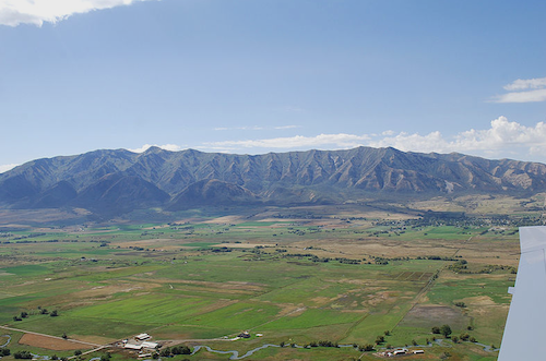
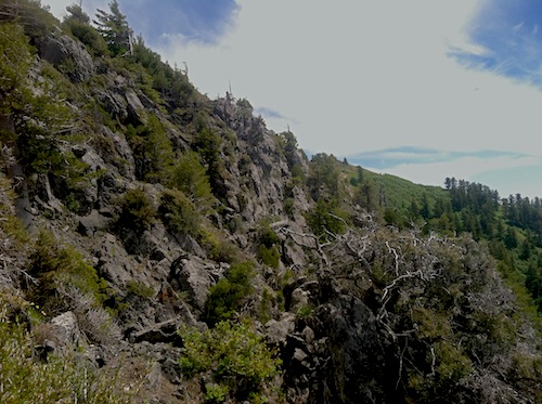
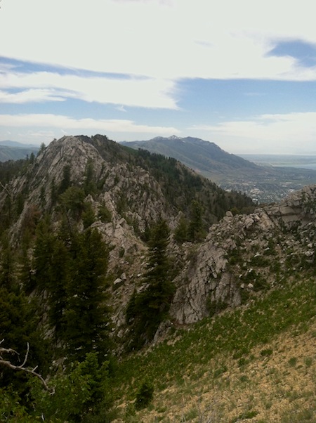
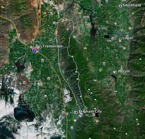
I’ve been wanting to check out the northernmost end of the Wasatch for ski potential. And what we lack for snow right now can be more than made up for with deep scrub brush and thickets. Behold THE STEEPEST MOUNTAIN RANGE IN NORTH AMERICA as photographed from the east over Logan. The range runs over 20 miles with 10,000 feet of elevation gain and descent. It seemed easiest to start in the north and work south, right to left in this photo.
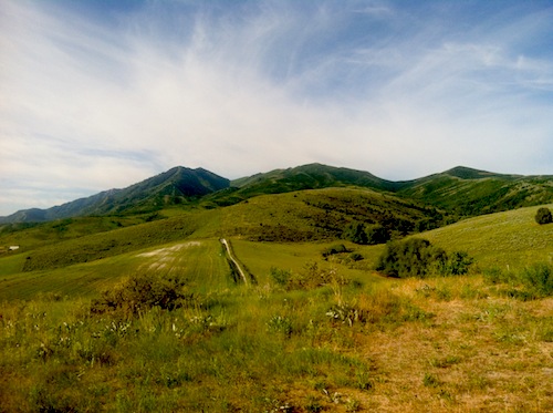
I hate inviting people on these sorts of outing because they really aren’t “fun” at times and I prefer to keep my mind free for wondering instead of feeling responsible for the sufferings of others. So, once again I found myself solo. Starting in the foothills, some gentle and rolling cattle roads acted as the gateway.
Temps were cool around 8am, though that was a later start time than I’d wanted.
The roads climbed gradually up and out of the foothills and the thicketeering began.
Two hours in I reached the ridge line of the range. I met a local guy here who was surprised to see me and told me I didn’t have enough water to complete the traverse, though he’d never done it. It turned out he was right, but luckily I’m too stubborn to listen to the people offering good advice in my life.
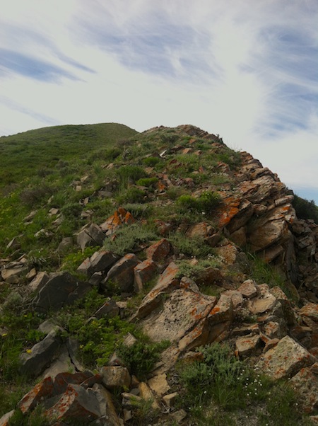
Once up on the range it becomes very clear that this truly is THE STEEPEST RANGE IN NORTH AMERICA! Ok, not really, but it does drop off quickly to the valley’s on both sides and there really aren’t any foothills, it just plummets. A skiing paradise I imagine, if snow can even stick to slopes that steep. Anybody want to SUP the Bear River? Looks like fun from here.
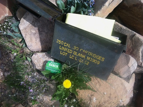
Someone was kind enough to stock the Mendon Peak summit register with some of the “10 essentials” as well as a packet of ranch dipping sauce. Well played.
Concerned about my water supply I scratched into this rare and pristine patch of snow to top off my fluids and feel better about the long and VERY STEEP mountains to come.
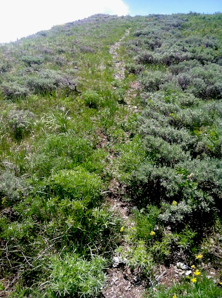
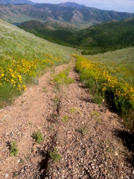
Ahhhhhhh…..trail! From Mendon Peak there were faint trails that became well developed once I hit Stewarts Pass. And they continued on allowing the possibility of quicker travel. Some serious gastrointestinal issues limited my ability to run, but luckily that worked it’s way out after a few miles.
This local hiker and I met near the top of the Box Elder (Bob Stewart Peak on some maps) and he had some great news! He mentioned that back in the 70’s there was a race all along the range and that I would find trail all the way to Brigham City! This was a big relief, from my examination on google earth I hadn’t seen anything and figured it to be rough overland travel. The first guy was right about something I hoped was wrong and this guy turned out to be wrong about something I hoped was right. Next time I’m taking headphones.
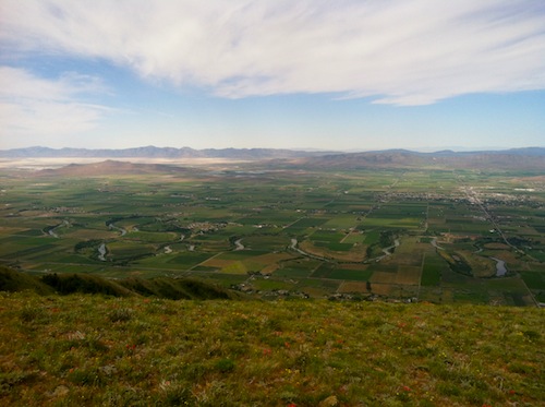
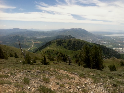
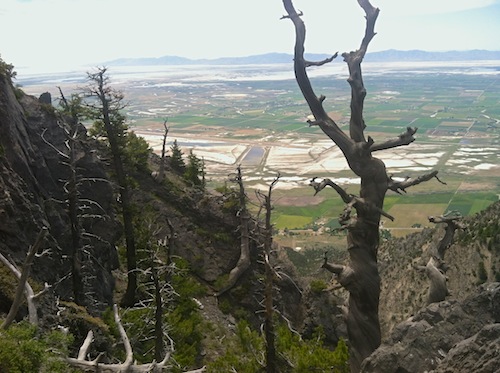
Twelve miles in and about that many to go. Looking south with my destination of Brigham City off and to the right. Doesn’t look that bad right!?
The well beaten path lasted for maybe a mile and then things petered out. The 70’s were a long time ago and there were very few hints of trail from this part on.
Expecting hell is fine since you prepare for it and expect it. Then when you’re told it’ll be easy and you encounter this, it’s a kick in the mental nuts. Maybe folks were just tougher in the 70’s.
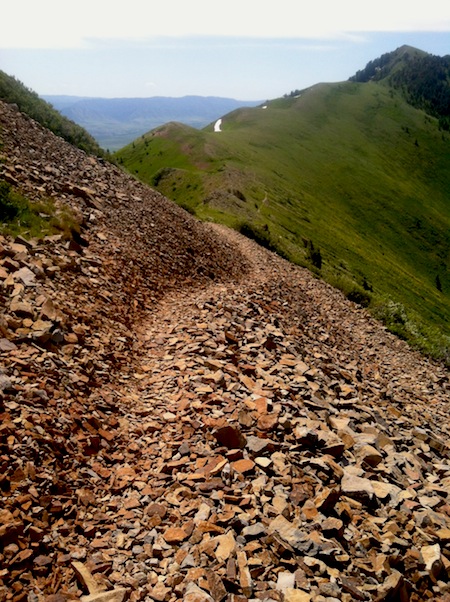
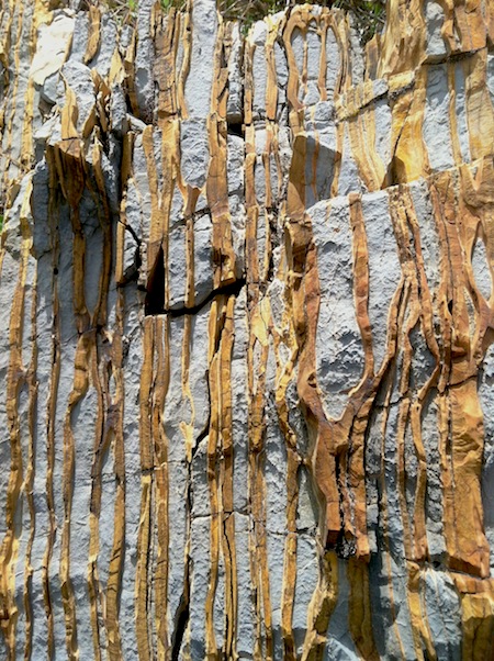
I took it easy, marked some good looking chutes with my gps and enjoyed the strange and very loose rock along the way.
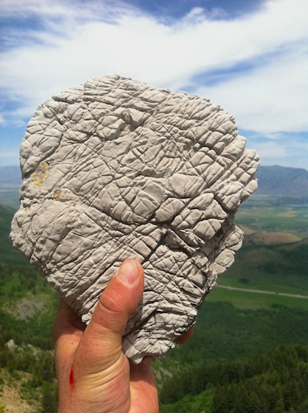
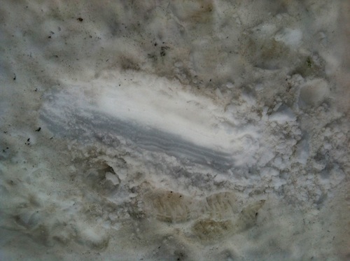
Never seen anything like this! Anybody know what it is?
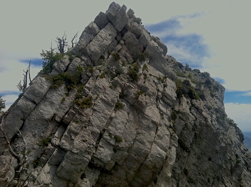
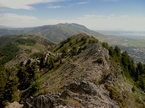
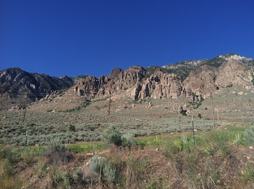
Viewing the ridge from I-15 it looks pretty straight forward without much scrambling. I was surprised to find so much rock.
The novelty of the traverse was wearing out about this point. Nothing to do but keep going……
…….and going.
“Search for the seed of good in every adversity. Master that principle and you will own a precious shield that will guard you well through all the darkest valleys you must traverse. Stars may be seen from the bottom of a deep well, when they cannot be discerned from the mountaintops. So will you learn things in adversity that you would never have discovered without trouble. There is always a seed of good. Find it and prosper.”
-Og Mandino
My shield wasn’t working.
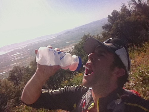
Water was rationed at mile 18 and last gulps were taken at mile 20. Counting on some Gnarly Boost to push me those final miles.
Finally got back onto some double track trail which led to the final summit! Dehydration was setting in, but the legs felt good enough to run it out from here.
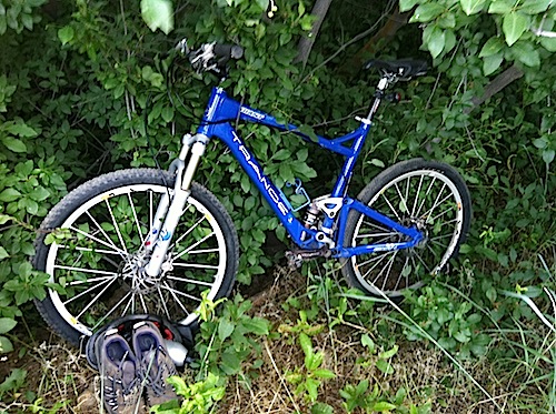
Back down in the foothills of Brigham city I located my cached bike, some fluids and gels.
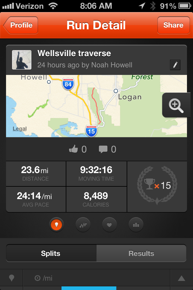
I recently starting using the Strava app. It’s an easy way to track routes and keep record of times and mileage without eating up your battery like some GPS apps. And in cases such as this it allows you to marvel at how slowly you moved.
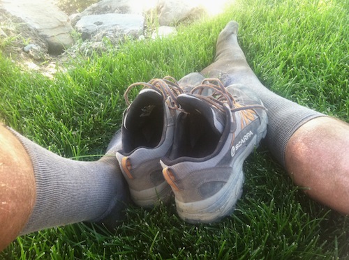
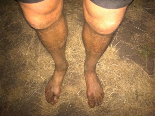
A good samaritan invited me inside to load up on ice and water. My lower extremities were very happy to switch over to the bike. Digging my epic shoes, perfect for epics.
The car was still a 26 mile pedal away, but biking was a welcomed change. I hit every sprinkler along the way and stopped to get thoroughly douched a few times.
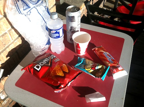
Fill ‘er up! Gas station dinner of salt, sugar and ice. The fridges were barely cold and no soda fountain so I bought my own bag of ice. Ghettolicious.
Kinked my neck cranking it up to view those steep mountains.
The sun was setting on the day as I wrapped up my first (and last) ride of the season. I sold my bike the next day to prevent myself from future stupidity. And so I’d stay focused on trail running.

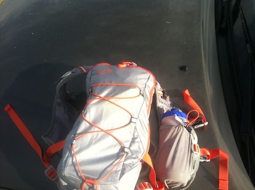
Product plug! This was my first time using the MHW Fluid Race Pack and I really like it! The way it hugs your body is great, it travels better than a traditional pack. It’s also small so you won’t be tempted to add those little unnecessary items, like ranch sauce.
Long and dirty day of self flagellation. Very excited to get back up there this winter and ski some lines in THE STEEPEST MOUNTAIN RANGE IN NORTH AMERICA!
Finally did it! Almost wish I hadn’t. https://www.strava.com/activities/5420614872
🙂 did this a while back : https://flickr.com/photos/10969685@N00/sets/72157606899518305 and just failed this past Sunday due to time and heat and water. Hell of a mountain.
Nice Mark!Yeah, it’s toasty this time of year.
Awesome report Noah!
Been planning out a splitboarding mission into these hills this winter, your photos are a great help.
I’ll be looking forward to a winter report as well.
Nice job! Sounds like “fun”, only different! Thanks for sharing. I was wondering where you started on the north end. It doesn’t appear that you went up Deep Canyon, so I was wondering where you went and how was the access roads? Did you need high-clearance and/or 4wd or can a sedan make it? Thanks.
Thanks Tad,
Access was a sinch and no 4X4 necessary. I just turned off of highway 30 at N 400 West and followed that South for a bit until I hit a neighborhood and drove up a hill, parked near a water tower and started up a dirt road into the foothills.
oops, I meant June 15th.
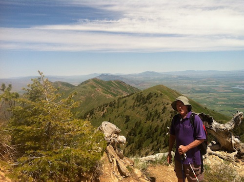
Congrats on the epic thru-hike (and bike)!! When people say they are hiking the Wellsville Range they usually mean Deep Canyon (300 N in Mendon) to Rattlesnake (Hwy 89). That was the race course back in the ’70s, before wilderness area and the USFS killed the race (you were on your own once you passed Rattlesnake). That’s the route I was hiking with my dog, just behind you on the 25th. Some guys told me about your adventure when I reached Wellsville Cone, pretty sure one of them was the guy in purple in your picture. Glad I found your post! Oh, and for what it’s worth, there is a spring just east of the saddle between Wellsville Cone and Box Elder (some say Bob Stewart) peak. I was up there again yesterday and replenished my camel back from the spring. Good cold water coming out of a rust pipe in the hillside. At least I think it’s good. Guess I’ll know in two weeks if there was giardia present.
Oh, and the skiing IS incredible up there- I ski off the top usual anywhere from 3 to 8 times a year depending on the snow.
Thanks for the beta Jason! Nice to know abou the spring. Beautiful area, maybe we’ll see you up there this winter!